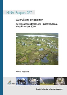
Overvåking av palsmyr. Førstegangsundersøkelse i Goahteluoppal, Vest-Finnmark 2006
Research report

View/
Date
2007Metadata
Show full item recordCollections
- NINA Rapport/NINA Report [2341]
- Publikasjoner fra CRIStin - NINA [2364]
Abstract
Hofgaard, A. 2007. Overvåking av palsmyr. Førstegangsundersøkelse i Goahteluoppal, Vest-Finnmark 2006. – NINA Rapport 257. 33 s. Overvåking av palsmyr er et nasjonalt overvåkingsprosjekt initiert av Direktoratet for naturfor-valtning, med oppstart i 2004. Prosjektet omfatter i alt fem utvalgte overvåkningsområder fra Finnmark i nord til Dovre i sør. I denne rapporten presenteres resultater fra førstegangsunder-søkelse i Goahteluoppal, Vest-Finnmark, som er det tredje etablerte overvåkingsområdet innen prosjektet. Rapporten presenterer en kortfattet bakgrunn for behovet for overvåking av palsmyr; relevante klimadata for Goahteluoppal; overvåkingsmetoder; og valg av delområder for detaljanalyser av palsformasjoner, markslagsfordeling, teledybde og vegetasjonsfordeling. De valgte delområdene representerer myrområdets typiske palsformasjoner med palsplatåer, kuppelpalser, dammer og erosjonsområder. Innen hvert delområde er det registrert posisjoner (GPS) og gjort detaljanalyser langs syv permanente analyselinjer. Posisjonene er registrert for frAmtidige reanalyser og for analyser av storskalaforandringer ved hjelp av flybildeanalyser. Resultatene fra linjeanalysene er presentert i tabeller og figurer som visualiserer småskalafor-delingen av markslag (10 variabler), bunnsjikt (6 variabler), feltsjikt (8 variabler), busksjikt (3 variabler), teledybde samt frekvens av torvsprekker og høyde. Analyselinjene er fotodokumen-tert og posisjonsregistrert med GPS for framtidige reanalyser hvert femte år. Det finnes flybil-der for området fra 1958 og 2003. En sammenligning av markslagsfordelingen innen myrene over denne 45-årsperioden viser til tydelige forandringer. Spesielt i de våteste myrområdene har arealet med pals minket og våte myrområder økt. Forandringene har klimatiske årsaker og da trolig fremst endringer i nedbørsregime (økt nedbør siden begynnelsen av 1900-tallet). Nes-te analyse av området er planlagt til 2011. palsmyr, overvåking, Goahteluoppal, Norge, vegetasjon, perma-frost, palsa peatlands, monitoring, Goahteluoppal, Norway, vegetation, permafrost Hofgaard, A. 2007. Monitoring of palsa peatlands. Initial investigation in Goahteluoppal, West-Finnmark 2006. – NINA Report 257. 33 pp.
The monitoring of palsa peatlands is a national monitoring project which was started in 2004 by the Norwegian Directorate for Nature Management. The entire project includes five selected monitoring areas from Finnmark in the north to the Dovre region in the south. This report pre-sents the results from initial investigations in the Goahteluoppal peatlands in West-Finnmark, which is the third established monitoring area within the project. The report presents a short background to the need for palsa peatland monitoring; climate data relevant to the Goahtelu-oppal area; monitoring methods; and selection of areas for detailed analyses of palsa forma-tions, and distribution of land cover types, ground frost and vegetation. Selected areas repre-sent palsa formations typical to the Goahteluoppal peatlands with its palsa plateaus, dome pal-sas, thermokarst ponds and erosion areas. Within the selected areas palsa positions are re-corded and detail analyses carried out along seven permanent lines of analyses. The palsa positions are recorded for future analyses of large scale peatland changes by the use of air photo analyses. Results from the line analyses are presented in tables and figures visualising small scale distribution of land cover types (10 variables), bottom layer (6 variables), field layer (8 variables), shrub layer (3 variables), ground frost depth, frequency of peat cracks, and height above the mire. GPS positions are given for all lines, and all lines are documented with photos for future re-analyses each fifth year. Air photos are available from 1958 and 2003. Thus, analysis of detailed temporal development is not fully possible. Comparison of the distri-bution of peatland land cover types over the 45 year period some apparent changes have oc-curred. In particularly, palsa areas have decreased and sedge areas increased in the wettest parts of the peatlands. There is a climatic background to these changes with emphasis on changes in the precipitation regime (precipitation has increased since the beginning of the 20th century). The next analysis of the area is scheduled to 2011.